- Free UK Shipping
- Worldwide Shipping
- Unique Product
- Satisfied Customers


Price range: £29.00 through £49.00
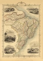
A beautiful map of Brazil, 1851.
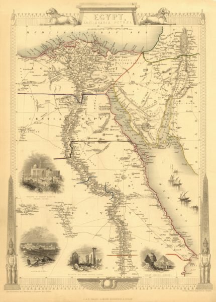
Illustrated around the margins, with beautiful vignettes of animals, structures, and people. The fine craftsmanship of the map can be seen in the colour illustrations in the four corners showing “Boats on the Rio Negro” (upper left), “St.Catarina” (upper right), “Monte Video” and “Cape St.Antonio, Bahia” (lower left), and “Rio de Janeiro” (lower right).
Drawn and engraved by John Rapkin. Published in the famous “Tallis’s Illustrated Atlas and Modern History of the World, Geographical, Political, Commercial and Statistical”. Tallis maps were known for their accurate designs, and numerous place names and geographical details, as well as for the use of shaded areas to indicate topographical features.
| Weight | N/A |
|---|---|
| Size | 37×52 cm, 60×86 cm |


No account yet?
Create an Account


Reviews
Clear filtersThere are no reviews yet.