- Free UK Shipping
- Worldwide Shipping
- Unique Product
- Satisfied Customers
Price range: £29.00 through £49.00
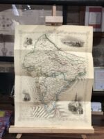
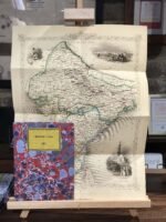
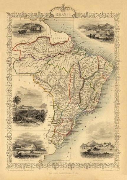
A beautiful map of BRITISH INDIA. This is a highly decorative and detailed mid-19th century map of India (including Nepal), which was drawn and engraved by J. Rapkin (vignettes by A. H. Wray & G. Greenback) and published in John Tallis’s Illustrated Atlas (London & New York: c.1851). An interesting feature of the map is the depiction of the then proposed railway lines running from Bombay to Delhi and Calcutta. From the first opening in 1853, the railway network has become an integral feature of modern India. The map has illustrated views of Lahore, Cootub Minar, Delhi; an Indian procession, and Belouche tribesmen.
| Weight | N/A |
|---|---|
| Size | 39×52 cm, 60×82 cm |


No account yet?
Create an Account


Reviews
Clear filtersThere are no reviews yet.