- Free UK Shipping
- Worldwide Shipping
- Unique Product
- Satisfied Customers

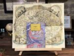
Price range: £29.00 through £49.00
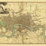
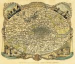
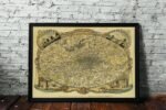
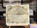
LONDON by Thomas Moule. This map shows an oval format, the environs of London – extent: Finchley, Woolwich, Norwood, Hanwell. The surrounding decorations are comprised of a portrait of Old Father Thames at the bottom center, cornucopias representing the commerce, agriculture, and riches of the Capital and surrounding districts. The vignettes are of New London Bridge, Hammersmith Suspension Bridge, The New Post Office, and Triumphal [Marble] Arch. Noted as the rarest of Moule’s maps.
| Weight | N/A |
|---|---|
| Size | 48×40 cm, 72×60 cm |


No account yet?
Create an Account


1 review for ENVIRONS OF LONDON, THOMAS MOULE 1837
Clear filters