- Free UK Shipping
- Worldwide Shipping
- Unique Product
- Satisfied Customers
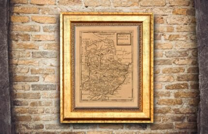
Price range: £29.00 through £49.00
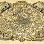
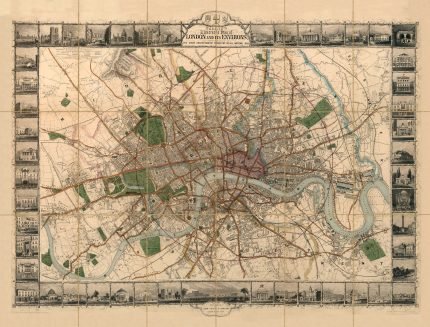
Laurie and Whittle’s map of London and its environs stretching from Islington to Camberwell and Bow to Paddington, an area now completely engulfed by the urban sprawl. The proposed sites of Vauxhall and Waterloo bridges are denoted by dotted lines, and the area of the city is delineated with a red line. The title contained within an attractive cartouche with a beehive, man-o-war, and the Union Jack and City arms symbolising the might and riches of the centre of the then rapidly expanding British Empire.
| Weight | N/A |
|---|---|
| Size | 51×38 cm, 83×60 cm |


No account yet?
Create an Account


3 reviews for LAURIE & WHITTLE’S NEW MAP OF LONDON 1809
Clear filters