- Free UK Shipping
- Worldwide Shipping
- Unique Product
- Satisfied Customers
£29.00 – £49.00Price range: £29.00 through £49.00
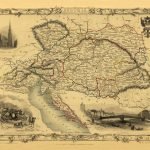
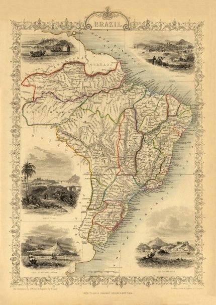
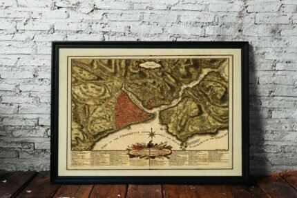
Map of Belgium, steel engraving with ornamental borders map appeared in “The Illustrated Atlas, and Modern History of the World Geographical, Political, Commercial & Statistical, Edited by R. Montgomery Martin.” London, Edinburgh, and Dublin. The Illustrations by J.Marchant & Engraved by J.B.Allen. The Map Drawn & Engraved by J.Rapkin.
| Weight | N/A |
|---|---|
| Size | 52×38 cm, 80×61 cm |
Europe | Zone 1 | Zone 2 | Zone 3 | |
|---|---|---|---|---|
Small Map Size | £9.90 | £11.20 | £12.25 | £11.35 |
Large Map Size | £14.20 | £20.35 | £22.10 | £23.75 |
Illustrations (tube) | £12.65 | £16.45 | £17.60 | £18.35 |
World Zone 1: Covers all countries, not defined as being in Europe or World Zone 2. (World Zone 1 generally covers countries in North America, South America, the Middle East, the Far East and South East Asia).
World Zone 2: Australia, Belau(Palau), China (including Tibet), East Timor, Fiji, French Southern and Antarctic Territories, French Polynesia, Guam, Japan, Kiribati, Korea, Marshall Islands, Micronesia, Mongolia, Nauru Islands, New Caledonia, New Zealand, Norfolk Island, North Marina Island, Papua New Guinea, Philippines, Pitcairn Island, Samoa, Solomon Islands, Singapore, Taiwan, Tonga, Tuvalu, Vanuatu, Wake Island, Wallis and Futuna Islands, Western Samoa.
World Zone 3: USA


No account yet?
Create an Account
1 review for BELGIUM 1851
Clear filtersThere are no reviews yet.