- Free UK Shipping
- Worldwide Shipping
- Unique Product
- Satisfied Customers
£29.00
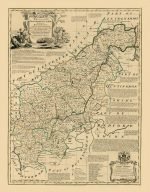
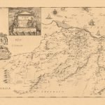
An Accurate Map of Northampton Shire. Divided into its Hundreds and laid down from the best authorities assisted by the most approved Modern Maps, with various improvements. illustrated with Historical Extracts relative to its Natural Produce, Trade, Manufactures & present State of its principal Towns. By Eman:Bowen Geographer to His Majesty.
| Weight | N/A |
|---|---|
| Size | 40×51 cm |


No account yet?
Create an Account


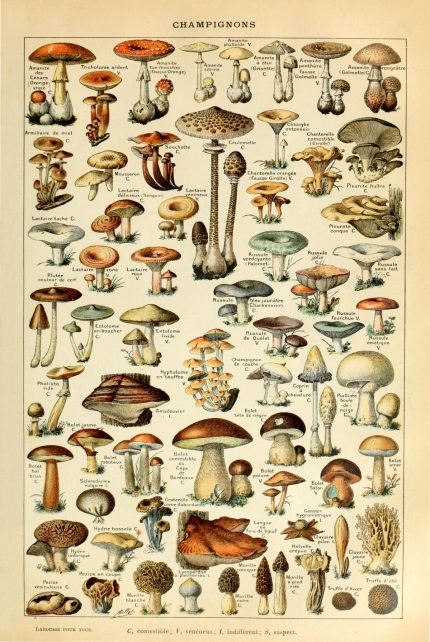
%20Circa%201897&url=https://www.oldmapslibrary.com/product/mushrooms-champignons-circa-1897/&media=https://www.oldmapslibrary.com/wp-content/uploads/2023/07/Adolphe_Millot_champignons-pour_tous-536x800.jpg)
Reviews
Clear filtersThere are no reviews yet.