- Free UK Shipping
- Worldwide Shipping
- Unique Product
- Satisfied Customers
£29.00
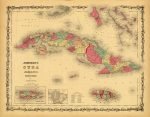
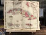
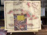
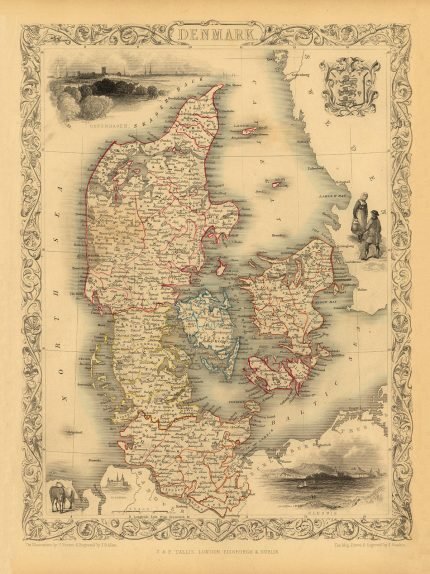
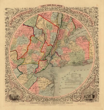
A beautiful map of Cuba, Jamaica, the Bahamas, and Porto Rico.
This map also shows part of the Florida Keys. Offers superb detail of the entire region, including roadways, cities, provinces, and undersea dangers. Two insets in the lower left detail Porto Rico and the City and Harbour of Havana, Cuba. Features the strapwork style border common to Johnson’s Atlas work from 1860 to 1863, and it was part of the 1862 edition of Johnson’s New Illustrated Family Atlas.
| Weight | N/A |
|---|---|
| Size | 52×40 cm |


No account yet?
Create an Account


Reviews
Clear filtersThere are no reviews yet.