- Free UK Shipping
- Worldwide Shipping
- Unique Product
- Satisfied Customers
£29.00
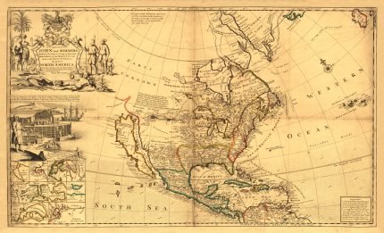
Map of CENTRAL AMERICA. The map depicts from southern Mexico and the Yucatan peninsula south to the extreme northern Costa Rica. Mexico, Belize, Guatemala, Honduras, El Salvador, Nicaragua, and Costa Rica are labelled, as well as both the Pacific and Atlantic Oceans and numerous islands along the Atlantic coast. Three beautiful vignettes are included, the volcano of Izalco, which is in El Salvador, the Great Square of the Antigua in Guatemala, and a scene from Belize.
| Weight | N/A |
|---|---|
| Size | 51×40 cm |


No account yet?
Create an Account


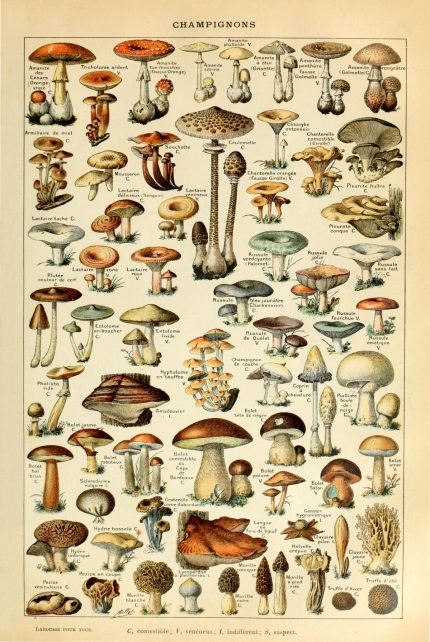
%20Circa%201897&url=https://www.oldmapslibrary.com/product/mushrooms-champignons-circa-1897/&media=https://www.oldmapslibrary.com/wp-content/uploads/2023/07/Adolphe_Millot_champignons-pour_tous-536x800.jpg)
Reviews
Clear filtersThere are no reviews yet.