- Free UK Shipping
- Worldwide Shipping
- Unique Product
- Satisfied Customers
£29.00
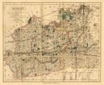
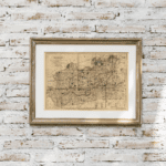
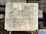
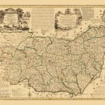
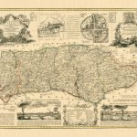
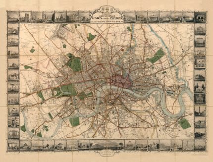
A fine map of Surrey, 1845 by J&C Walkers. The principal rivers are the Thames, which flows along the northern boundary of the county, and is navigable throughout. A canal has been cut from Basingstoke to the Way. The Greenwich, Croydon, Brighton and South Eastern Railways traverse this county from north to south, and the south-western from Vauxhall Bridge westward through the county.
| Weight | N/A |
|---|---|
| Size | 49×40 cm |


No account yet?
Create an Account


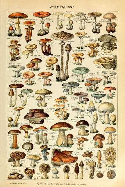
%20Circa%201897&url=https://www.oldmapslibrary.com/product/mushrooms-champignons-circa-1897/&media=https://www.oldmapslibrary.com/wp-content/uploads/2023/07/Adolphe_Millot_champignons-pour_tous-536x800.jpg)
1 review for SURREY 1845
Clear filters