- Free UK Shipping
- Worldwide Shipping
- Unique Product
- Satisfied Customers
£29.00
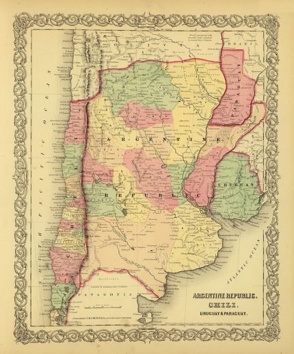
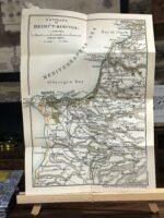
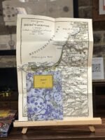
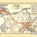
Environs of Beirut (Berytus). Antique colour tourist map by Wagner & Debes.
This map is originally from “Palestine & Syria, with routes through Mespotamia and Baylonia and the island of Cyprus”, handbooks for travellers by Karl Baedeker. 5th edition. Leipzig
YEAR: 1912
CARTOGRAPHER : Wagner & Debes
| Weight | N/A |
|---|---|
| Size | 36×51 cm |
Europe | Zone 1 | Zone 2 | Zone 3 | |
|---|---|---|---|---|
Small Map Size | £9.90 | £11.20 | £12.25 | £11.35 |
Large Map Size | £14.20 | £20.35 | £22.10 | £23.75 |
Illustrations (tube) | £12.65 | £16.45 | £17.60 | £18.35 |
World Zone 1: Covers all countries, not defined as being in Europe or World Zone 2. (World Zone 1 generally covers countries in North America, South America, the Middle East, the Far East and South East Asia).
World Zone 2: Australia, Belau(Palau), China (including Tibet), East Timor, Fiji, French Southern and Antarctic Territories, French Polynesia, Guam, Japan, Kiribati, Korea, Marshall Islands, Micronesia, Mongolia, Nauru Islands, New Caledonia, New Zealand, Norfolk Island, North Marina Island, Papua New Guinea, Philippines, Pitcairn Island, Samoa, Solomon Islands, Singapore, Taiwan, Tonga, Tuvalu, Vanuatu, Wake Island, Wallis and Futuna Islands, Western Samoa.
World Zone 3: USA


No account yet?
Create an Account
Reviews
Clear filtersThere are no reviews yet.